Wednesday, June 27, 2012

Boston walking tour brought to you by....

...Insight Guides Boston Step by Step! I owe a huge thank you to the authors of the Boston walking tour book I used. It had such helpful tours, tips, and maps that got me from historical site to historical site in Boston and the surrounding area. Much of my blog posting must be attributed to their insight (ha! get it, insight?) and information. Thank you, Insight Guides!

A few more points of interest in Boston:

Public Garden: the oldest botanical garden in the United States, with expertly manicured flower beds and lots of squirrels scampering from place to place. As I walked through the garden, I saw a woman with her dogs, a leash in each hand, her arms held out, as each dog tracked and stared down a separate squirrel. I was afraid (and I think she was, too) that she would be drawn and quartered by her two terriers! In the Public Garden, you can take a swan boat ride (popular since 1877) around the lagoon. There is also a rather magnificent statue of George Washington on horseback. According to Thomas Jefferson, George Washington was the finest horsemen of the age (thanks, again, Insight Guides!).

Hatch Schell, Charles River, Esplanade: On our Friday night in Boston, my husband and I found our way to a pedestrian bridge to take us across the busy Storrow Drive to get to the Charles River. As we were crossing, we saw that there was a movie playing in the Hatch Shell. On Fridays in the summer (from what I surmise), they play free movies in the Hatch Shell for the people of Boston. People were scattered about the green on their blankets watching Happy Feet 2. What a fun Friday! The Hatch Shell is also where the Boston Pops play their concerts, most notably on the Fourth of July with accompanying fireworks show (which you can watch on TV from Phoenix, too!). We walked to a dock on the river where a number of other couples and families were enjoying a picnic dinner as the sun set across the river. It was quite lovely. On our way back to our hotel, we wandered through the Esplanade, a treed, grassy riverside park equipped with a lagoon and gondolas!

Photo taken from the top of the Green Monster
Back Bay Fens and Fenway Park: Looking for a spot for dinner, my husband and I wandered down Beacon Street until we stumbled onto Boston University and busy Commonwealth Avenue. While dining on some tasty pizza, I noticed the unmistakable lights of a baseball stadium -- Fenway Park! While we didn't take a tour that evening (there wasn't even a game that night, but the lights were on...), we returned on our last day in Boston to take an inside peek at America's smallest and oldest major league stadium (it is celebrating its 100th birthday this year, just like the state of Arizona!). From Fenway we walked along the Back Bay Fens, a "reedy marshland along the Muddy River," as my guide book states. The Fens are a part of the Emerald Necklace, nine green spaces in Boston designed by the same man who designed New York City's Central Park.

While I wasn't able to see every part of Boston, I did see a lot. I definitely know which areas I'll hit up next time I'm in town!

Trip to Hahvahd

Good day, history buffs! Today I shall take you through my walk around Harvard [pronounced Hahvahd by the locals] University and the surrounding area of Cambridge.

A little background info: Harvard University is the nation's oldest university, founded in 1636, and is still considered one of the most prestigious in the United States. A number of US Presidents have earned degrees from Harvard, including John Adams, John Quincy Adams, the Roosevelt boys (Theodore and Franklin), John F. Kennedy, Rutherford B. Hayes and Barack Obama (who earned law degrees), and George W. Bush (who earned his MBA). As it would appear, 5 out of 8 Harvard grads like to use their middle initials in their names.

Since my hotel was in Boston, I had to take the T across the river to Cambridge. Upon emerging from the underground station, I found myself just outside Harvard Square. As I approached some impressive gates that appeared to be holding the secrets of Harvard, I noticed what a busy, bustling area the square was. I thought back to my college days: only in the 10 minutes before and after classes was any part of my college this busy.

Photo newenglandtravelplanner.com
I stepped through the fancy Johnston Gate and into Harvard Yard [Hahvahd Yahd]. Each side of the walkway is flanked by old buildings, including Harvard Hall and Massachusetts Hall. Straight ahead, across a large lawn snaked with walkways, a crowd gathered in front of a statue sitting before University Hall. This statue is of John Harvard, but is infamously known as 'The Statue of Three Lies." Why? you might ask. Well, according to my guide book, this statue is not of John Harvard (lie #1), it's actually of an undergraduate student from 1884. The inscription on the statue also claims John Harvard to be the founder of Harvard College, when he was actually just the first major benefactor (lie #2). Finally, the inscription also states that the university was founded in 1638, but it was founded in 1636 (lie #3), as we all now know.

It also appears that this statue has a ritual attached to it; many universities have little rituals like this. The University of Maryland has a bronze statue of their mascot, Testudo the Terrapin (turtle), which good luck-seekers pat on the head as they pass by. At Northwestern University, students paint a rock in the Quad, decorating it however they decide, and guarding it day and night to prevent other students from painting over it. My own alma mater, Creighton University, installed a bluejay statue outside the new soccer stadium in my senior year; the school encouraged students to touch the beak on their way into the stadium for "good luck". In this same vein, the statue of John Harvard has become a harbinger of good luck. Supposedly if one touches his toe, they will have good luck. Many many tourists were lined up to get a picture of themselves touching "John Harvard's" toe. I did not, nor was I able to get a good picture due to the throngs of tourists. In any case, I nabbed a photo from the interwebs. Look for the shiny gold toe.

From this statue I walked around University Hall and into New Yard (or Tercentenary Quadrangle -- New Yard is way easier to spell and pronounce). This green area is surrounded by Memorial Church, Sever Hall, University Hall, and the impressive and looming Widener Memorial Library. As badly as I wanted to run up the concrete steps and run through the columns of books I suspected were inside, I was not allowed. It is not open to the general public. I guess I'll have to enroll in order to check it out. The library itself is named after a Harvard graduate, Harry Elkins Widener, who drowned when the Titanic sank in 1912.

From New Yard I wandered past some museums under construction and toward Memorial Hall. Now, I love grandeur, history, and fancy buildings. I especially love them on college campuses. I was, however, not prepared for Harvard's Memorial Hall. This building dates back to 1874 and houses some classrooms as well as the university's largest auditorium. I wanted to sneak inside to see the stained-glass windows, but I couldn't figure out which door was the entrance. :(


From Memorial Hall I wandered a bit, meandering through the different buildings and complexes. Much of the grounds were under construction (as often happens during the summer months), but I was impressed with the amount of people who were in and out of buildings, seemingly conducting research, attending classes, or otherwise being scholarly in the summer months. I returned to Hahvahd Yahd, reading in my guide book that many of the brick buildings lining the green space are freshmen dormitories. How amazing would that be? They look so fancy!

I exited back through Johnstone Gate and continued my trek through Cambridge. I walked the sunny streets, past cute and quaint shops, finding more buildings belonging to Harvard, as well as those once belonging to the women-only Radcliffe College (established in 1879), now integrated into Harvard. I found my way to Cambridge Common, a lovely park full of screeching soccer players and some historical sites. A semi-circle of cannons, a plaque, a headstone, and a tree all mark significant moments in American revolutionary history: the spot where George Washington assumed command of the Continental Army and the spot of British abandonment. It was apparently under the tree that Washington agreed to take command of the army; they have since fenced it in and added a marker to denote its significance. The cannons, according to the marker, were abandoned by the British when they left Boston in 1776.

From Cambridge Common I walked back along Brattle Street to see some of the more prestigious houses in cambridge. Many of the houses sported little blue plaques indicating their historical significance, as most date from the 19th century and some from even earlier. For example, the delightful Longfellow House has been preserved at number 105. This gorgeous house, dating from 1759, is where Henry Wadsworth Longfellow composed some of his most famous works, including The Song of Hiawatha and "Paul Revere's Ride". Wadsworth lived in this house as a renter for many years before receiving it as a wedding gift and retiring to live there full-time; the house was also the former headquarters of one George Washington. It is now a preserved historical site.


From the Longfellow House I wandered back through Cambridge, delighting in the busy little streets and shops, the people milling about small squares and parks. I stopped into a cafe for a quick iced green tea and continued my trek toward the Charles River. Once upon the river, I crossed a very busy bridge and snapped a picture looking back toward Harvard. On the other side of the water is the Harvard Business School, where none other than George W. Bush earned his MBA. The business school is equally regal yet quaint as it's on a smaller scale. The small quads and old buildings reminded me of the many colleges I visited in Virginia the summer after my junior year. I cannot get enough of historic colleges!

I crossed another bridge to return to the other side of the Charles River, walking back toward the main campus. I snapped another picture from the bridge (I could barely even see over the bridge, the pillars were so tall!). You can mostly only see trees, but the cupolas of the buildings peek out over the treetops. Jealous of the green, Phoenix? I sure am!

After crossing the bridge, I headed back to Harvard Square to catch the T to head back to Boston. It was a lot of walking, especially after a day of even more walking (The Freedom Trail) and I was quite tuckered out when I got to my hotel!

Stay tuned for one last blog post acknowledging the wonderful guide book that took me on my many journeys and gave me so much information, as well as a bit more info about a few other sites I stopped by.

Click here to see information about the book I used for my tours and information.

Friday, June 22, 2012

The Freedom Trail Part Six

Plaque along The Freedom Trail
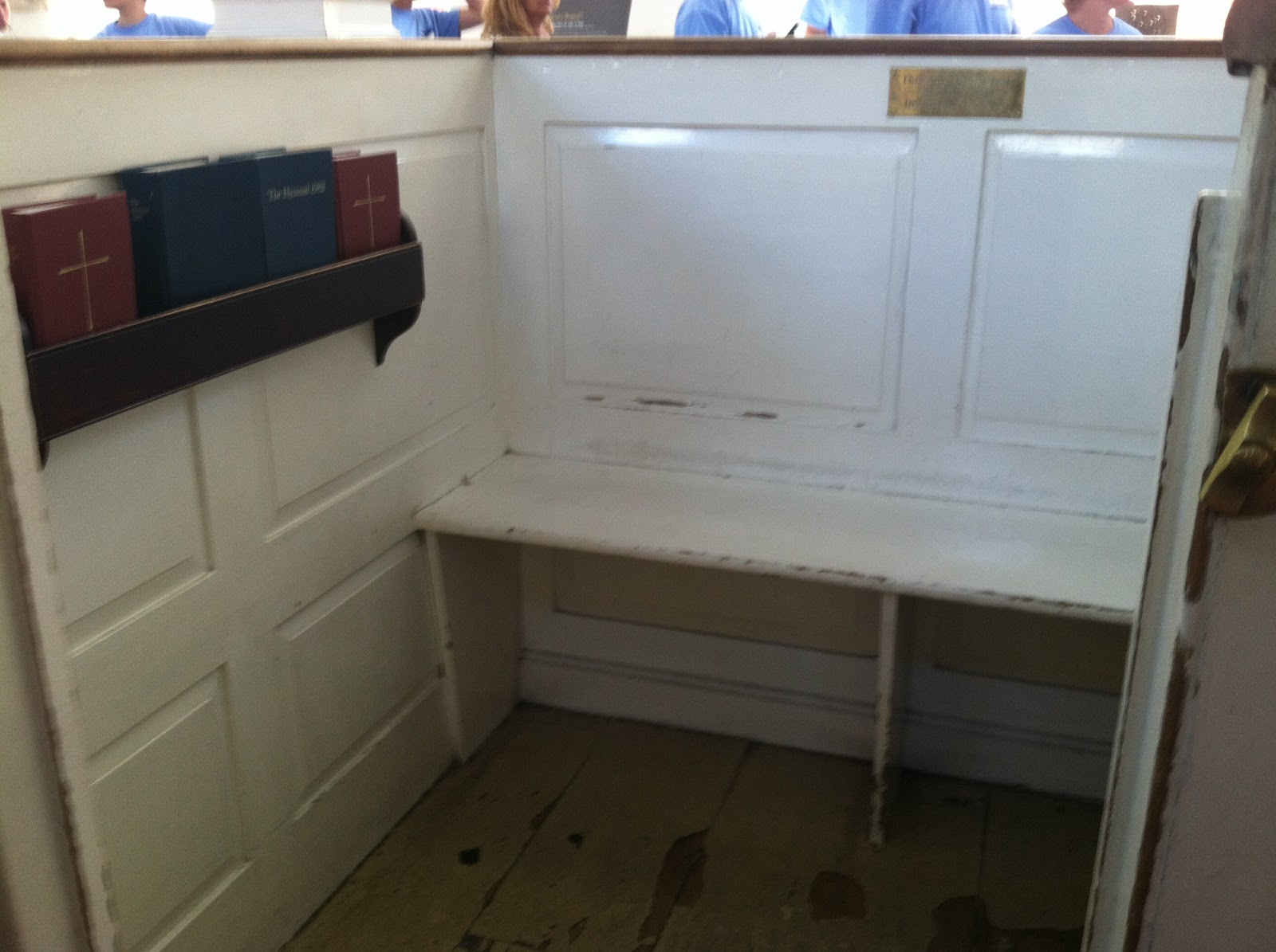
When last we parted, dear ones, I was finishing up my fun and fortuitous stop at the Old North Church!

From there I headed along Hull Street and stopped to take a picture of the Old North Church from the outside. I wanted to be sure to capture the steeple, as that steeple changed American history! What do you think would have happened if Paul Revere hadn't thought to alert Charlestown that the British were moving? Would the British have gotten to Lexington and Concord before Revere did?

At that point, I finally thought to take a picture of The Freedom Trail I had been following for the last few miles. How silly of me for not taking a picture sooner.
See, you know it's really me because of the shoes.


Just up the hill from my shoe was Copp's Hill Burying Ground. This is Boston's second oldest burial ground (behind King's Chapel Burying Ground). I did not spend much time in this cemetery, though I did notice one gravestone in particular, that of Captain Daniel Malcolm. His headstone is speckled with dark spots. As I looked in my guide book, I saw that there was a bit of a story to Captain Malcolm. He was famous for smuggling goods into the port without paying the fee. Before he died he asked to be buried "in a Stone Grave 10 feet deep," to prevent his body from being vandalized or harmed. His body was never harmed, though his headstone did not fare so well. The speckles on his headstone are the results of the British using his grave for target practice.

From Copp's Hill Burying Ground I wandered my way down the hill (Copp's Hill, as it were) toward the Charles River. I crossed the river on a busy roadway and pedestrian bridge, taking a brief moment to soak in the sight of seeing water and old, still-working locks that help control the water into the harbor. Sadly, however, I did not think to take a picture for when I might be water-thirsty back in the desert.

Once across the bridge, I realized I was in Charlestown, that famed town that Paul Revere had scouts in to see the steeple of the Old North Church. The city itself is actually two years older than Boston, but who's counting? I turned onto a lovely little street and stopped at a cafe for lunch (that's right, I'm just getting to a lunch break!). I had a delightfully tasty prosciutto, fig, and goat cheese sandwich and enjoyed it in the breezy air of the Charles River.
Look at that deliciousness.
After my little break, I continued along Constitution Road toward the Charlestown Navy Yard. Inside the Charlestown Navy Yard is the USS Constitution, the world's oldest warship still in operation. It's not used for missions (thankfully), but maintains its operational title by being pulled into the harbor every Fourth of July before being returned to its home, according to my guide book. The USS Constitution was built in Boston and first sailed in 1797. The fun nickname of the Constitution is "Old Ironsides."  According to my guide book, Ironsides won 42 battles from 1797 to 1855 when it was retired from active duty. Its nickname is said to come from an interaction with the British ship Guerriere in 1812; when the cannonballs of the British seemed to bounce off the sides of the ship, a sailor exclaimed, "Her sides are made of iron!" In fact, the ship's sides were not made of iron, but instead from live oak, a wood reported to be five times stronger than white oak.

I did not wait in line to get a tour of Old Ironsides from the guides sporting 1812 sailor garb. Instead, I wandered toward the edge of the water and snapped a couple pictures, one of the ship, and one looking back over the Charles River to Boston and Copp's Hill. Can you see what I see?


Before leaving the Navy Yard, I stopped at another ship that was resting in the dry docks, receiving some repairs and TLC. This ship, the USS Cassin Young, served in the Pacific during World War II. Compare that to the Constitution, used less than 100 years before it!

From the Navy Yard I wandered the streets of Charlestown, diverting from the Freedom Trail temporarily, and taking in the beautifully kept gardens and houses of Charlestown. Much of it is reminiscent of San Francisco, and I found myself smiling as I climbed through the streets.

Eventually I merged back up with the trail and came upon Winthrop Square, once a training field for the young men (boys) of Charlestown to learn and train for the militia. At the corner of the park is a plaque honoring all those lost on June 17, 1775. More on that in a bit.

I walked through the square and up a slight hill until a large obelisk rose before me. The Bunker Hill Monument. Now, don't be as confused as I was. The obelisk itself is not on Bunker Bill, but Breed's Hill. Right? Confusing. The actual battle was fought just north of the commemoration site.

I climbed a number of stairs to be confronted with quite the statue, the statue of Colonel William Prescott. Prescott is famed with (allegedly) saying, as the British approached during the Battle of Bunker Hill, "Don't fire until you see the whites of their eyes!", a kind reminder to the inadequately trained militia to hold their fire until they were sure it could make an impact. In my picture, the obelisk is rising starkly behind Prescott's tilted hat.


It may be appropriate now to give a bit of history to the Battle of Bunker Hill. This battle is one of the more notable battles, not because it was a victory for the American revolutionaries (because it wasn't), but because it showed the tenacity and perseverance of the colonial fighters. Also, the British victory didn't really give the Brits any sort of advantage. Both sides suffered tremendous losses and the territory gained did not outweigh the loss of life for the Brits.

To put it simply, the British were expected to try to take both Bunker and Breed's Hills north of Boston in order to secure the area around Boston more fully. When Colonel William Prescott and his comrades heard about this, they quietly occupied the hills and set up troops across the Charlestown area. The British attacked the next day, June 17, 1775, failing at the first two attempts and losing many men. They finally succeeded in their third attempt as the colonial groups retreated to Cambridge.

Feeling that I hadn't walked quite enough that afternoon, I decided to climb the 294 stairs to the top of the Bunker Hill Monument, feeling it important to see Boston from one of its highest vantage points this side of the river. Now, it was breezy and cool, though sunshiny at the time. I was ill-prepared for the climb and how sweaty I would become at the top of the twisty, twisty, spiral staircase. The room at the top is absolutely tiny; there were about 8 of us up there and we each had to take turns shuffling around the hole in the floor (where the stairs were) so we didn't fall or push each other down. However, there were four windows from which to peek upon the town below! In some of the pictures you will see rings -- it is from these rings that flagpoles were secured and flags flew from the windows of the monument when it was completed in 1842.

Looking south/southeast toward Boston.

Looking west/southwest through one of the flag holders.

Looking west/southwest, not through the flag holders.

Looking north/northwest toward the battle site and river.

Looking southeast toward Boston. Can you see the steeple of the Old North Church? The USS Constitution?
After descending the 294 stairs, I hustled across the street, past the statue of Prescott, and into the Bunker Hill Museum to find some paper towels to dab myself dry. I'm warning you: if you climb this monument, you will sweat. Take a towel.

At this point, I checked my watch and found it time to start the trek back to Boston for dinner.  I continued to follow parts of the trail and the walking tour. I did find the Warren Tavern (though I had since abandoned the end of The Freedom Trail), an establishment dating back to 1780, where both Paul Revere and George Washington once stayed.

I found my way to a T station (that's the Boston subway) and rode back into the city. As I walked back to my hotel, I decided to stop inside the beautiful and historic-looking Boston Public Library. That's right, I go into libraries when on vacation. And, trust me, if you go to Boston, you should stop at this library, too. It's quite the labyrinthian building and I wandered many hallways as I explored. But my wanderings were well rewarded! Lion statues flanked a grand staircase upon entering the library. It took some slinking around windows, but I finally found this magnificent courtyard in the middle of the library, equipped with a fountain AND a restaurant!


And, OMG, how spectacular is this room? I could read here every day!

While this concludes my journey along The Freedom Trail, it does not conclude my trip to Boston! Stay tuned for one more blog post about my trip to Hahvahd (that's Harvard to the rest of us).

Click here to read about my trip to Harvard!

Click here to read about the book I used for my tours and information.


Wednesday, June 20, 2012

The Freedom Trail Part Five

Good day, young historians!  We're embarking on one of the more exciting legs of The Freedom Trail journey!

Having just left the shady bricks of Paul Revere Mall (the Prado), a crowd of tourists emptied onto a tight corner split by a sign saying, "For church, enter here." Feeling adventurous (and how could I not, given the many adventures I had been taking that day), I scooted to the side of the sign that would gain me access to the church. I was anxious to get inside the church, as I had no clue where I was. Upon entering, I could tell the church was old. It had pew boxes and was constructed of wood. Almost immediately, a man at the front of the church spoke to all of us, "In about 3 minutes I'll be giving you a presentation about the history of the Old North Church. Come on in and have a seat." A couple volunteers of the church then started opening the pew boxes and inviting people to sit down. Quickly I sat down in the nearest box, getting my bearings.

The pew box had benches in almost every direction and a closing door, as well as a very short kneeler and a shelf holding books. As I looked to my right, a golden plaque shone in the sunlight.


What? I exclaimed silently. Nearly 100 years ago Teddy Roosevelt sat in this pew, and now I'm sitting here! How cool am I? I began to flip through my guide book to find information on the Old North Church. As soon as I found the page, the volunteer at the front of the church began to explain the history.

Not only did I find myself in the pew box once sat in by Theodore Roosevelt, but I was in the church in which the lanterns were lit to signal that the British were on the move. This church is terribly significant and I had no idea!

Old North Church is Boston's oldest church, dating back to 1723 (almost 200 years before Teddy Roosevelt ever sat it in, and 289 years before I sat in it!). The clock, organ case, and Belgian cherub statues (pictured at right) also date back to the opening of the church. The actual organ, though, only dates back to 1759, and is still in use every Sunday. How many churches have you been to that use a 253-year-old organ? Fun fact about the statues: they were on a ship headed toward Nova Scotia in Canada, a gift to a French church, but were intercepted by a British pirate who confiscated them and later donated them to the Old North Church upon its opening! Those cherubs are legit pirate booty! The pew boxes maintain the original character of the church; the boxes were meant to keep parishioners warm during the winters. Each pew box would have a brazier (box) of coal to keep in their pew box. The folks at the Old North Church have even preserved a pew box as to what it would have looked like in the 18th Century -- quite fancy compared to the stark wooden pews dotting the rest of the church.


 (You can see the lavish cushions and tapestry lining the preserved pew box, including the little coal brazier on the floor between the kneeling cushions. Compare that to the white pew box with Teddy plaque where I had been sitting.)


Continuing on with the historical significance of the church, beyond its duration as a functioning church, Old North Church is, as I had said before, the church from which the lanterns were hung to signal that the British were coming. To elaborate, on April 18, 1775, British troops were secretly moving through the night to Lexington and Concord, hoping to confiscate weapons from these cities and return to Boston. Alerted to the plan, the Sons of Liberty sent Paul Revere to ride to the countryside to warn the townspeople. This seemed risky, so Revere asked Robert Newman, caretaker at the church, to send a signal across the river to Charlestown, in case he was captured before alerting everyone. As Old North Church was the tallest building in Boston at the time, Revere was sure it would be seen across the water. Robert Newman agreed to the plan, and in complete darkness, he went upstairs to the balcony and entered a door now covered by the organ (see photo of organ). From there he climbed the 14-story steeple, again in complete darkness, and lit and hung two lanterns in the steeple window. They did not remain there all night -- likely less than a minute --, as this would alert the British to something fishy. And it did. Before Newman could get downstairs, the British were at the front door of the church, demanding to know what was going on. Instead of confronting the British, Newman fled to the back of the church and through a window just right of the altar. This window is commemorated and now designated as the Newman Window. The church has hung a replica lantern in the window, which President Gerald Ford lit on the country's bicentennial, 200th birthday, in 1976.

Why two lanterns, you may ask? Well, as the famous poem, "Paul Revere's Ride", by Henry Wadsworth Longfellow tells us, "One if by land, two if by sea." This means that one lantern should be hung if the British were moving across the land toward Lexington and Concord, and two lanterns should be hung if they move through the water, a much quicker route.

Click here for a map showing the routes!

Now I must mention that, according to the information in the Old North Church, it has never been confirmed whether it was Robert Newman who hung the lanterns that night. It is presumed that he and one or two other men did it because Newman had keys to the church as caretaker, but it has never been confirmed. The church has also preserved the pew box where his family sat.

Finally, one more piece of historical excitement from the Old North Church: just above and to the right of the Newman family pew box rests a bust of George Washington. According to my guide book, this bust was the first public memorial to George Washington, and was said by the Marquis de Lafayette, a French general who fought with Washington during the Revolutionary War, to be "more like him than any other portrait."

Now, I know I only covered one site in this entire post, but can you now see why it was such an historically exciting site? How lucky I am that I decided to wander into this church. Had I passed it by and later read about it in my guide book, I should have been so upset.

Stay tuned for the next installment of my journey (and yes, this was still all in the same day!) that will take me to Copp's Hill Burying Ground and across the Charles River into Charlestown!

Click here for full text of Henry Wadsworth Longfellow's poem "Paul Revere's Ride". 

Click here for The Freedom Trail Part Six!

Click here to read about the book I used for my tours and information.

Tuesday, June 19, 2012

The Freedom Trail Part Four

Yum! The men would slice them open right in front of you!
When last we parted we were at the New England Holocaust Memorial. From there I traveled along the Blackstone Block, a charming cobblestone-street lined with old brick buildings dating back to the 1600s. Along this strip is Union Oyster House, a restaurant occupying the oldest brick house in Boston. Within the walls of Ye Olde House (as it is sometimes referred), Boston's first town crier lived, the Massachusetts Spy newspaper was printed, and Louis-Philippe, later to become king of France, taught French upstairs. Not only that, but in 2012, I ate oysters there!


Yes, that's my orange shirt reflected in the sign!
Continuing along the cobbled streets of the Blackstone Block, I came across the Ebenezer Hancock House. According to the placard, it is the only remaining house in Boston associated with John Hancock, the first signer of the Declaration of Independence and the man who forgot to sign his own will! Please note how well-preserved the buildings are in Boston. This building dates back to 1767 and still looks fantastic. Boston truly has done an excellent job preserving its history. Americans should be grateful!

According to my guide book, I was supposed to find the Boston Stone, a stone ball used as the point from which all distances from Boston were measured, embedded in a building just across from the Ebenezer Hancock House. I failed. I wandered this cobbled corner for about 5 minutes, still coming up short. However, I did find the Green Dragon Tavern, the unofficial commemoration of where the Boston Tea Party was planned and from where (allegedly) Paul Revere was sent on his famous ride to Lexington. The actual Green Dragon Tavern was demolished in the 19th Century, but this modern version is a nice homage.

I continued north for the second half of The Freedom Trail, officially having finished my first walking tour and embarking on my second. I walked through a lovely park before I entered the delightful North End and all its Italian cafes and restaurants. I meandered through the streets, bobbing and weaving between some slower Freedom Trail walkers -- why I decided I needed to speed walk The Freedom Trail, I'll never know. But you all have seen me walk through the hallway -- I'm a woman on a mission!

Eventually I walked into North Square and immediately noticed two very striking and well-preserved buildings: Paul Revere House and Pierce-Hichborn House. The Paul Revere House is the oldest wooden house in downtown Boston. It was built in 1680. Can you believe that? Revere moved into the house in 1770; the house is currently a non-profit museum furnished much as it was when Revere lived there. The Pierce-Hichborn House was owned by a cousin of Revere and mostly has significance in terms of its architectural departure of wooden Tudor houses of the previous century.

From here I journeyed to the Paul Revere Mall, past St. Stephen's Church, the bell of which is one Paul Revere cast himself, and enjoyed a leisurely stroll through what North Ender's refer to as the Prado, or the Paul Revere Mall. The shaded brick courtyard, fountain, and plaques gave me a nice respite from the sunny streets, and allowed me to snap a picture of a statue of Paul Revere. Join me for the rest of my journey on the other side of the Prado!


Monday, June 18, 2012

The Freedom Trail Part Three

We last met at the Old South Meeting House, a site steeped in the history of the Boston Tea Party (get it, steeped? One steeps their tea before drinking it??).

From the Old South Meeting House I walked along Washington Street until I saw the Old State House where Washington and State Streets meet. According to my guide book, the Old State House is the oldest public building in Boston, built in 1713 as the colonial government seat. It is from the balcony of this building that the Declaration of Independence was read on July 18, 1776. Its origin as a British colonial building is evident from the golden lion and unicorn statues on the roofline, symbols of British imperial power. The original statues were thrown off the building when the Declaration of Independence was read.

Just below the balcony of the Old State House is a brick circle in the sidewalk, memorializing the site of the Boston Massacre. It on this spot, on March 5, 1770, a group of upset colonists were throwing insults and snowballs (well, snowballs filled with rocks) at a group of British soldiers standing guard outside the Old State House. The soldiers opened fire into the crowd, instantly killing three men, two more later dying from injuries. The colonists were to refer to it as the Boston Massacre, an event to fuel their dissatisfaction with imperial rule; the British refer to it as the Incident on King Street.


From the site of the Boston Massacre I traipsed along Congress Street to a bustling plaza. This is the busy Faneuil Hall and Faneuil Hall Marketplace (most likely pronounced Funnel, but many Bostonians cannot even agree to this). Faneuil Hall, named after Peter Faneuil, is a former public hall, reported as the "Cradle of Liberty," as the Sons of Liberty held many of their disgruntled sessions within these walls. In front of the hall, amidst throngs of people, actors pretending to be statues, and break dancers, a statue of Samuel Adams, one of our Founding Fathers, looks upon the street.

To gain the lovely view of Faneuil Hall and its glittery cupola (pictured right), I crossed Congress Street to climb the steps toward current Boston City Hall. From here I fell into giggles as I compared the site of current City Hall against the description in my guide book. The book refers to it as a "charmless, inverted ziggurat"and its surrounding area "the vast, empty, and depressing City Hall Plaza." The book couldn't be more correct.


I walked around the remainder of the huge City Hall Plaza, taking in its expansive concrete wealth, and headed to the New England Holocaust Memorial. In stark contrast to the old world brick buildings that line the nearby streets, the Holocaust Memorial rises amidst the trees, six tall glass towers, each pane of glass etched with the numbers of the 6 million Holocaust victims. Even more eerie than the numbers, each tower has a vent at its base, hissing steam upwards, a quiet reminder of the way in which so many had been murdered.


 Stay tuned for the next installment of my journey along The Freedom Trail!

Click here to jump to Part Four!

Click here to read about the book I used for my tours and information.